Journal of Geology & Geophysics
Open Access
ISSN: 2381-8719
ISSN: 2381-8719
Research Article - (2016) Volume 5, Issue 4
This present study, in general, was carried out to assess arsenic in deep groundwater resources in the catchment area of Kadey, East-Cameroon and to predict arsenic mobilization process in relation to copper (indicatives aspects), iron, manganese, pH and ORP. Seventy-two (72) deep groundwater samples were collected during twenty four months between January 2014 and December 2015. The depths of the wells were ranged from 7 to 34 m. In year 2014 and year 2015, arsenic concentration in 17% and 26% of examined groundwater wells, respectively exceeded permissible World Health Organization (WHO) guideline value of 0.010 mg/L for drinking water. The concentrations of arsenic were in the range between arsenic is medium correlated with copper. The strong negative correlation between arsenic and ORP indicates that arsenic mobilization occurs under reducing condition. These distinct relationships indicate that arsenic release is considered to be affected by the reductive dissolution of Fe/Mn oxides in the groundwater. Arsenic has very weak negative correlation with pH suggesting less effect of pH on arsenic mobilization. Arsenic is not significantly correlated with the season which infers similar distribution of arsenic in both seasons. Arsenic varies spatially in groundwater of the valley showing high concentrations in central groundwater district.
Keywords: Deep groundwater, Reductive dissolution, Arsenic, Catchment area of Kadey, WHO
Today, heavy metal contamination of groundwater is one of the major problems in the world. The heavy metals that occur as natural contaminants of groundwater and are potentially bio-hazardous include manganese (Mn), lead (Pb), cadmium (Cd), mercury (Hg), cyanide (Cn) and arsenic (As) [1,2]. Like cyanide an mercury, arsenic is recognized as a toxic element and has been classified as a human carcinogen affecting skin and lungs [3]. Arsenic has strong toxicity at even low concentrations and can accumulate in body tissues over long periods of time and is nonessential for human health [4,5]. So, elevated levels of arsenic constitute problems for water supplies around the world [6]. In recent past years, the occurrence of high concentrations of arsenic has been detected in groundwater from a number of regions across the world. The problem has increased greatly in recent years in several regions of Africa. In those regions, countries affected with arsenic in groundwater include South Africa, several states of Nigeria (Kano, Adamawa, Taraba, Oyo, Delta Imo Lagos and Edo), Chad, Central Africa Republic, Gabon and Cameroon (East and South regions) [7,8].
The demand for water is increasing due to rapid growth of urban population and industrial activities (mining exploration; mining extraction and treatment of precious stones) in the Kadey catchment. There is a high decadal population growth rate found in Kadey district i.e., 57.19% [9]. As a result there is an immense pressure on groundwater resources in the catchment. Groundwater was first exploited for water supply in 1990 in the catchment. Mechanized extraction of groundwater resources began in 2005 with the implantation of Non-Governmental Organizations (NGOs). Groundwater is an important water resource in the Kadey catchment. It contributes about 57% of the total water supply in the catchment [10]. In dry season, 67% to 74% of the water supply is met by ground water [11].
There have not been several studies of assessment of arsenic in groundwater of Cameroon in general and specially in groundwater of the Kadey catchment. Groundwater survey of the catchment reported the presence of arsenic and the concentrations were below World Health Organization (1993) guideline values [12]. Similar study revealed that the ground water resource in the Delta state of Nigeria is contaminated with arsenic in deep aquifers [13]. Likewise, other studies have reported elevated levels of arsenic in groundwater of Bouar and Mbaïki (Central Africa Republic) [14]. With the mercury and cyanide, arsenic in groundwater wells in the Kadey catchment is one of the major environmental issues due to its negative health impact and more than 55% of water supply in the area is derived from groundwater resources. So, this paper presents an overall study on the occurrence, mobilization and distribution of arsenic in deep groundwater resources in the catchment. The study attempted to visualize spatial distribution pattern of arsenic in Kadey catchment groundwater in GIS environment. The study also aimed to demonstrate temporal (seasonal) variation of arsenic. The possible relationship between arsenic and depth of the groundwater was also examined.
Study area
The Kadey catchment area (2 647 km2) is located in Eastern Cameroon, between longitudes 14°29’E and 14°45’E and the latitudes 4°12’N and 4°36’N (Figure 1). The basin is located in the equatorial climate transition upstream from the part of the basin located south of the Sanaga. As for the entire Congo Basin, annual average rainfall is 1 428.9 mm between 1960s and 2015s. The rainfall pattern has four seasons marking the equatorial influence. The distribution of seasons varies following stations (Bertoua; Abong-Mbang; Batouri and Meiganga). However, the aspect “camel’s back” characterizes all stations of the Sangha Basin, with two maxima and two minima well marked, the second maxima always been the most powerful. The highest temperatures are observed between March and April and are respectively 25.4°C Batouri, 25.9°C Dem and 26°C to Bertoua [15]. In terms of the lowest temperatures, they correspond to the months of July and August, with 23°C in Batouri, Bertoua 23.4C and 23.9°C to Dem (Figure 2). The hydrographic network of the basin narrows upstream downstream. The relief consists of upstream basin plateaus, plains in the middle and downstream lowlands whose altitude varies between 600 m and average 880 m. However, there are isolated ancient massifs whose peaks reach around 927 m (Figure 1). The geology of the catchment area consists of base for the most part [15]. The population is predominantly rural and relatively dense. The main economic activity remains artisanal gold mining although agriculture remains the main activity in the whole of Congo.
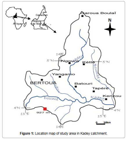
Figure 1: Location map of study area in Kadey catchment.

Figure 2: Bagnouls and Gaussen ombrothermic diagram (Kadey at Batouri, 1964-2015).
Water sampling and analysis
The study was carried out in 72 deep groundwater wells, six points in the Kadey river and two sources during the years 2014 and 2015 (Figure 3). The study covered the groundwater wells of 7 to 34 m depth. The geo-positions of groundwater sampling locations were determined using global positioning system (GPS). Random sampling technique was used to collect groundwater samples. The locations of all the samples were recorded by handheld Garmin-E GPS and referenced to WGS 84 coordinate system. The high density polyethylene (HDPE) sampling bottles were treated with 5% HNO and then rinsed with double distilled water. Samples from wells were collected by using 500-mL Nalgene (UK) HDPE bottles. A set of samples were collected in sampling bottles after pumping water for five minutes to get the representative samples of groundwater wells. The bottles were labeled with the sample code number. These samples were preserved as per APHA-AWWA-WEF [13] and then brought to the laboratory for the analysis. The samples were kept at 4°C prior to analysis. Oxidation reduction potential (ORP), electrical conductivity (EC), pH and temperature were measured in situ at each sampling locations. The ORP and pH were measured by Hanna HI 8314 pH/ORP meter (Italy). The EC was measured by Jenway 4200 conductivity meter (UK).

Figure 3: Sampling locations map.
The analysis of total arsenic, total iron, total manganese, total copper and total lead were carried out in Tanzania standard (NS) certified-CEMAT Water Laboratory by using Varian AA 240 atomic absorption spectrometer (AAS). The analysis of arsenic was carried out using Varian AA 240 atomic absorption spectrometer (Nigeria) with vapor generation accessory VGA-77 (Nigeria). The standard solutions produced by Merck, Germany traceable to standard reference material (SRM) of NIST (National Institute of Standards and Technology, Gaithersburg, MD, USA) were used to prepare calibration standards. The samples for the analysis of arsenic, iron and manganese were digested with high purity HNO3 (Merck) within a week of sample collection as per APHA-AWWA-WEF (2005). Sample digestion with the HNO3 allows total extraction of the metals from the samples. Three replications of each analysis were performed and mean values were used for calculations. Analytical reagent blanks were prepared for each batch of the digestion set and then analyzed for the same elements as the samples. Analytical precision was in good agreement, generally better than 5% RSD. SPSS version 18 was used for all statistical analyses.
Today, Cameroon adopted universal transverse mercator (UTM) projection for the base mapping of the country with some modifications suited to its shape. This is named as modified universal transverse mercator projection. So, all the spatial data layers were maintained in a standard Cameroonian coordinate system of modified universal transverse mercator, central meridian 84° longitude (i.e., MUTM 84). The software used for mapping and spatial analysis was ArcGIS version 9.3.
Physicochemical parameters and metals
In the Table 1, we have presented the synthesis of values of pH, EC, ORP and the concentrations of metals in the groundwater wells. All the pH was acid and ranged from 5.4 to 6.4. The EC ranged from 92 to 1715 μS/cm (mean = 567 μS/cm), 93 to 1666 μS/cm (mean = 565 μS/cm) in pre monsoon and post monsoon, respectively. The elevated EC value is mainly due to geological sources since groundwater contamination is less in deep aquifers due to presence of widespread thick lacustrine clay beds that significantly restrict downward percolation [16] and leaching of ions contributing conductivity would be limited.
| Variable | Unit | Year 2014 | Year 2015 | ||||||||
|---|---|---|---|---|---|---|---|---|---|---|---|
| Min. | Max. | Mean | Med. | SD | Min. | Max. | Mean | Med. | SD | ||
| PH | 5.4 | 6.4 | 5.7 | 5.6 | 0.5 | 5.2 | 6.4 | 5.6 | 5.4 | 0.5 | |
| EC | μS/cm | 92 | 1715 | 567 | 452 | 381 | 93 | 1665 | 567 | 456 | 379 |
| ORP | mV | -161 | 134 | -59 | -76 | 68 | -120 | 135 | -49 | -56 | 55 |
| Depth | m | 7 | 34 | 13 | 17 | 57 | 7 | 34 | 13 | 17 | 57 |
| As | mg/L | BDL | 0.137 | 0.011 | 0.003 | 0.024 | BDL | 0.131 | 0.013 | 0.005 | 0.023 |
| Fe | mg/L | BDL | 11.09 | 3.61 | 2.88 | 2.88 | 0.1 | 12.99 | 3.76 | 2.79 | 2.87 |
| Mn | mg/L | BDL | 1.55 | 0.44 | 0.37 | 0.35 | BDL | 1.75 | 0.42 | 0.31 | 0.4 |
Min. = Minimum; Max. = Maximum; Med. = Median; SD = Standard Déviation; BDL = Below Detection Limit.
Table 1: Summary of statistical data for physicochemical parameters and metals.
The mean values for ORP in the groundwater wells were -59 mV in pre monsoon and -49 mV in post monsoon. The negative ORP value was up to -161 mV indicates that the groundwater wells are under reducing condition. A study reported negative ORP value up to -195 mV in deep groundwater [14]. Likewise, another study indicated low ORP value in deep groundwater with mean value of -82 mV in pre monsoon and -56 mV in monsoon [17]. The groundwater wells in the study area are relatively anoxic, as indicated by low ORP values. The dominance of thick lacustrine clay probably restricts the downward diffusion of oxidants such as oxygen in deep groundwater [16].
The mean iron concentration in deep groundwater wells were 3.61 mg/L in pre monsoon and 3.76 mg/L in post monsoon with the highest concentration of 12.99 mg/L in post monsoon. Iron oxides dissolve under strongly acidic and reducing environment. If present in water in excessive amounts, it forms red Fe oxyhydroxide. Reductive dissolution of Fe (III) oxides accounts for the high Fe (II) content in anaerobic water [17,18]. The chemical composition of the major elements of the sediments, i.e., Fe2O3 ranged from 1.48 to 9.55 wt% [12] could be the source of iron in groundwater of the valley. A similar study indicated the Fe2O3 contents of the sediments are generally high (ranges < 0.5 to 15 wt%), and are uniformly higher in the fine sediments of the central basin (average 7 wt%) [8]. The overall bulk elemental concentrations in the central basin are greater in comparison with the northern part. The total iron content in the black sticky clay is high (>7 wt%) [19]. The variation in Fe2O3% and redox state of groundwater might have affected the levels of iron concentration in the groundwater.
Manganese concentration ranged from <0.02 to 1.55 mg/L (mean = 0.44 mg/L) in pre monsoon, whereas <0.02 to 1.75 mg/L (mean = 0.42 mg/L) in post monsoon. The chemical composition of the major element of the sediments, i.e., MnO from 0.01 to 0.18 wt% [20] is probable source of manganese in the groundwater of the valley. In the study area, arsenic concentration in the groundwater wells ranged from < 0.003 to 0.137 mg/L (mean = 0.013 mg/L) in pre monsoon and <0.003 to 0.131 mg/L (mean = 0.011 mg/L) in post monsoon. Arsenic concentration in 17% in pre monsoon and 26% in post monsoon exceeded provisional World Health Organization guideline value for drinking water of 0.010 mg/L [17]. A similar study reported arsenic concentration up to 0.265 mg/L [13]. Iron oxyhydroxides are the common host matter for arsenic, either adsorbed into the surface or co-precipitated [14] and reductive process is responsible for arsenic mobilization by dissolution or desorption in the groundwater [15,19], so it is possible that the higher concentration of arsenic in the groundwater is due to the more reducing environment as indicated by lower ORP value. Likewise, under the aerobic and acidic to near neutral conditions typical of many natural environments, arsenic is strongly adsorbed by oxide minerals as the arsenate ion and the concentrations in solution are low [20].
The groundwater wells observed elevated concentrations of iron and manganese. It is observed that the concentrations of iron and manganese are pH dependent and higher aggressiveness of iron and manganese in low pH [11]. Likewise, it is suggested that presence of a reductant (such as organic carbon) is a dominant factor controlling iron and manganese concentrations in groundwater. The oxidation of the reductant would leads to the reduction and solubilisation of iron and manganese [20] and the lacustrine clay in the Kadey catchment area is rich is organic matter [13] would contribute to the reducing environment. The organic matter may play an important role in the mobilization of arsenic, as reported by many studies from West Bengal (India) many states in Nigeria and Central Africa Republic [5,14,15]. It has been indicated that the fluvio-lacustrine sediments in the Catchment are rich in organic matter, and this organic matter may contribute in mobilization of arsenic.
Correlation between physicochemical parameters and arsenic
All the relationships of pH, EC, ORP and metals in the groundwater were examined by Spearman’s rank correlation coefficient (Table 1).
The pH has strong negative correlations with iron and manganese, and weak negative correlation with arsenic (r = -0.534, p < 0.01; r = -0.402, p < 0.01; r = -0.169, p < 0.129) which can be explained by the higher aggressiveness of acidic media towards soil and host rocks that increase the concentrations of the rest of the ions [11]. Though arsenic has negative correlation, p-value suggests that there is an insignificant negative correlation between arsenic concentration and pH in the groundwater.
The EC shows strong positive correlations (at p < 0.01) with iron, manganese and arsenic. Arsenic has strong positive correlations with iron and manganese (r = 0.384, p < 0.01; r = 0.447, p < 0.01), which is attributed to common geogenic origin of these metals.
The ORP has strong negative correlation with arsenic (r = -0.492, p < 0.01), which can be explained by reductive arsenic mobilization mechanisms in the groundwater. Likewise, ORP also shows negative correlations with iron and manganese. Reducing environment is responsible for the release of iron as well as manganese through the reduction of Mn (III, IV) hydroxides to soluble Mn (II) and of Fe (III) hydroxides to soluble Fe (II), respectively.
Correlation between arsenic and depth of groundwater
The depth of the deep groundwater wells tested arsenic ranged from 84 to 304 m. The mean and standard deviation (SD) of depth were 222.0 m and 63.4 m respectively (Table 2). The study showed weak positive correlations between arsenic and depth of groundwater in pre monsoon and post monsoon (r = 0.206, p = 0.196; r = 0.178, p = 0.266), respectively. Though, it showed positive correlations in both seasons, p-values suggest that there are insignificant positive correlations between arsenic concentration and depth of groundwater. However, it contradicts with the results shown by the some previous studies [13,15].
| Parameters | As | Mn | Fe | ORP | EC | PH |
|---|---|---|---|---|---|---|
| As | 1 | |||||
| Mn | 0.447* | 1 | ||||
| Fe | 0.384* | 0.656* | 1 | |||
| ORP | -0.492* | -0.447* | -0.570* | 1 | ||
| EC | 0.463* | 0.654* | 0.591* | -0.664* | 1 | |
| PH | -0.169 | -0.402 | -0.534* | 0.052 | -0.332* | 1 |
Table 2: Spearman’s rank correlation coefficients of physicochemical parameters and metals.
Temporal (seasonal) variation of arsenic
The temporal (seasonal) variation of the physicochemical parameters and metals were evaluated through season-parameter Spearman’s correlation matrix in the groundwater. The measured parameters are not significantly (p > 0.05) correlated with the season except for pH (r = -0.238, p < 0.05), which infers similar distribution of arsenic in both seasons. Arsenic concentrations were insignificantly varied between seasonal groundwater. A study also reported very similar distributions of arsenic for pre monsoon and monsoon [15].
The lack of temporal (seasonal) variation is attributed to less dilution effect of monsoon rainfall in the groundwater. Additionally, contribution of anthropogenic metal contaminations is reluctant in the studied time-series in the groundwater wells. These findings are consistent with the results of previous study which pointed out seasonal variability has no significant effect on deep groundwater quality [17]. The similar studies also indicated no seasonal variability of arsenic in the groundwater [15,16]. The reports on the temporal variation of arsenic concentration in other parts of the world are inconsistent. Significant variation in arsenic concentration among the seasons was observed in a study [20]. A study spotted no significant monsoonal effects on arsenic distribution [17]. The seasonal variability has little effect in the groundwater [18]. Likewise, limited temporal variability observed in arsenic concentrations in groundwater [21-23].
Spatial distribution of arsenic
The concentration of arsenic, iron, manganese and ORP value vary significantly in central, northern and southern groundwater districts in the valley. The spatial distribution pattern reveals higher values of arsenic, iron and manganese in central groundwater district. Northern and southern groundwater districts have lower arsenic concentrations in most of the groundwater wells. The concentration of the arsenic in groundwater of the study area increases from northern to southern and showing highest towards central groundwater district. Arsenic concentration was relatively lower in southern groundwater district in comparison with central groundwater district. The spatial distribution of ORP in the groundwater clearly shows most of the groundwater wells have lower ORP value.
The variations of elemental concentration are mainly clay controlled in both the margin and central parts. There is progressive increase in the finer particles and trace elements towards the central part of the sediments from the northern part in the valley [21] which is attributed to decrease in grain size and the concentration of metals in sediments tend to increase in fine grained sediments [2,11,12]. The larger particles in sediments have less surface area available for metal hydroxide coatings to form and adsorb arsenic and less adsorbed arsenic contributes a smaller amount of aqueous arsenic in equilibrium with adsorbed arsenic. Therefore, there is in less potential for release of arsenic through reductive mobilization mechanisms [19]. The variation in grain size has role in mobilization of metals in groundwater. Therefore, higher metal concentration is associated with the fine grained sediments in the central groundwater district. Furthermore, higher concentrations of metals in central groundwater district might be due to the fact that the central groundwater district is considered as poorly recharging due to the presence of a thick black clay layer [22].
Groundwater quality depends on the composition of recharging water, the mineralogy and reactivity of the geological formations in aquifers, anthropogenic activities and environmental conditions that may affect the geochemical mobility of certain constituents [23-25]. Arsenic concentrations in groundwater of the Kadey catchment area show a wide range and some of groundwater sources investigated were found to be in elevated levels in some parts of the basin could be due to the nature of the sediments there. The high degree of spatial variability in groundwater quality over short distances indicates that groundwater movement has been limited and is poorly mixed [24].
Arsenic concentrations in the sediments of the Kadey catchment area averaged 8 mg/kg (ranging 3 to 25 mg/kg) similar to the general level seen in modern unconsolidated sediments, typically 5 to 10 mg/ kg [26,27]. The widespread lacustrine clay of the Kadey catchment area could have greater potentiality for arsenic release [28]. Arsenic mobilization is high in the reducing conditions [17,26,29]. The higher concentration of arsenic under reduced groundwater environment may be due to Fe/Mn oxides and direct reduction of As (V) into As (III). After an initial increase, arsenic concentration often decreases again as a function of time below water table due to sulfide precipitation, whereas it increases with increasing sulfate concentrations above water table [30]. Under moderately reduced environment (0 to 100 mV), arsenic solubility seemed to be controlled by the dissolution of Fe oxyhydroxides. But at highly reduced condition, e.g., at -250 mV, arsenic chemistry is dominated by the formation of insoluble sulfides FeAsS, AsS, As2S3 [22] attenuating concentration of arsenic in the groundwater.
Firstly, this study has confirmed the presence of higher levels of arsenic in deep groundwater of the Kadey catchment area. Arsenic showed wide spatial variation ranged from <0.003 to 0.137 mg/L. In pre monsoon and post monsoon, 17% and 26% of groundwater wells, respectively exceeded arsenic concentration of permissible WHO guideline value of 0.010 mg/L for drinking water. The arsenic varies spatially with high concentration towards central groundwater district. Strong negative correlation between arsenic and ORP demonstrated reductive arsenic mobilization mechanisms in deep groundwater. Arsenic showed strong correlations with iron, manganese and EC. Iron and manganese are presumably the main factors in regulating release of As in groundwater through reductive mobilization mechanism. Secondly, the study revealed weak positive correlation between arsenic concentration and depth of deep groundwater. Arsenic is not significantly correlated with season suggesting similar distribution of arsenic in both seasons. The high concentration of arsenic in deep groundwater of some parts of study area particularly in central groundwater district is attributed to the groundwater geochemistry of the study area. Release of arsenic into the groundwater is considered to be due to the natural source under the reductive process.
The authors would highly acknowledge Sub-Regional Bilingual University of Mining, Sciences, Technology, Yaounde-Cameroon for the support of this research work. We would like to thank First Aid – International Medical Assistance (PU-AMI).