Journal of Geography & Natural Disasters
Open Access
ISSN: 2167-0587
ISSN: 2167-0587
Research Article - (2015) Volume 5, Issue 2
Over 80% of Lesotho populations’ livelihood is dependent on rain-fed agriculture (IFRC, 2009), and during dry periods local communities suffer severely from the drought impacts. The main focus of this study was to assess vulnerability to agricultural drought at Koti-Se-Phola Community Council (CC) in order to determine the conditions of vulnerability; who and what is exposed to drought, examine coping mechanisms used against drought in the study area and to provide relevant decision makers with information on drought that can be used for effective interventions. The study followed both quantitative and qualitative methodology where 5 villages were sampled. The selected sample comprised of both employed and unemployed respondents. The total sample size considered in this study was 102. Questionnaires were distributed to household heads and an interview was held with agricultural extension officers based at an agriculture project at Ha Bofihla for expert opinion and to validate responses obtained from household members. Data was captured in Microsoft Excel for analysis and SPSSV16 was used for reliability testing where the Cronbach alpha coefficient was found to be 0.764. From the selected drought indicators, a composite vulnerability index was established. Main findings of this study were that the Koti-Se-Phola community council was found to be vulnerable to drought with other emerging issues such as high unemployment, elderly residents whose alternative income is old-age pension perched at M450 per month. Government responses to drought were found to be inadequate. Very few animals-labour especially cows were used for draught power in ploughing. However, many have devised means to cope with drought through stockpiling of maize stalks, using lekhale and torofeiye as well as chicken droppings to feed their cattle during droughts. Socially, some members have been sent away for job-seeking and others especially young boys were forced to pick up piece jobs as shepherds to reduce food consumption and social burden on the families. The general Agricultural Vulnerability Index was 0.4874 which complemented the qualitative results about the high vulnerability conditions at KotiSe-Phola Community Council. Suggestions were made by the respondents that employment-generating and poverty alleviation projects should be put in place such as, the installation of irrigation systems at Makhaleng River. Agricultural conservation projects were also requested that could curb high soil erosion identified in the study area. Given the current drought vulnerability situation, the researchers strongly recommend amongst others diversified livelihoods and increased agricultural conservation where unskilled community members could still earn a sustainable living even during dry spells.
Keywords: Agricultural drought, Vulnerability, Disaster, Coping capacity
Of the many natural extreme events, drought is the most obstinate and pernicious hazard that can last for long and extend over large areas than any other natural hazard [1]. Drought disasters have caused severe human sufferings in the world dating as far back as the beginning of man-kind. Negative impacts created by droughts are not only visible in economic terms but also have far-reaching effects. Drought impacts are felt across many economic sectors such as food, water and energy [2]. Direct economic damages caused by disasters alone have amounted up to US$75.5 billion in the last decade [3]. The same source estimates that about 85 percent of the people in the developing countries are exposed to natural disasters and therefore it is imperative that disaster risks are reduced in order to achieve sustainable development [3,4]. Disaster risk is given by the equation: Disaster risk = Hazard × Vulnerability/Coping capacity [4,5]. For an effective and efficient Disaster Risk Reduction (DRR), both hazard and vulnerability assessment must be conducted. Given that over 80 percent of Lesotho’s population is dependent on rain-fed agriculture [6] and that Mafeteng District is one of the poorest and most vulnerable to climate-induced disasters, vulnerability assessment was essential. No research studies have been undertaken in the past that are drought-specific at a community level. This study therefore assessed the vulnerability of Koti-Se-Phola Community Council to agricultural drought in order to alert authorities of the present conditions and enable them plan against drought episodes so as to increase local community resilience.
Lesotho is a lower-middle income country with a total surface area of 30,000 km2 and a population of 2.3 million people [7]. Lesotho is ranked number 158 out of 186 countries according to 2012 UNDP Human Development Index [8]. Lesotho is said to be one of the most vulnerable countries to drought with Mafeteng being one of the districts that is hard-hit by prolonged drought and erratic seasonal rainfall patterns [8]. Lesotho is divided into ten administrative districts; Maseru, Berea, Leribe, Butha-Buthe, Mokhotlong, Thaba- Tseka, Qacha’s Nek, Quthing, Mohale’s Hoek and Mafeteng (Figure 1). Lesotho is further categorized into four distinct agro-ecological zones namely: lowlands, foothills, mountains and Sengu River Valley. These zones are characterized by distinct differences in climatic and ecological conditions. Mafeteng district comprises of mainly lowlands and only a small portion consists of foothills. In these zones, the top soil is sandy and susceptible to both wind and water erosion due to overgrazing (BOS, 2010). Lesotho has a temperate climate with very cold winters and hot summers. Temperatures get down to -7°C in the Lowlands in winter. The yearly precipitation is between 600 and 1,200 millimetres in the Lowlands whereas the annual precipitation in the country is between 700 and 800 millimetres. This large variance in rainfall leads to periodic droughts [7]. The districts are further subdivided into 128 district councils. Mafeteng District is subdivided into twelve community councils, namely; Koti-Se-Phola, Makaota, Makholane, Malakeng, Malumeng, Mamantsi’O, Monyake, Mathula, Metsi-Maholo, Qibing, Ramoeletsi, and Tajane. Koti-Se-Phola is found in the south of this district and is partly lowlands and foothills. Within this community council area, there is the Makhaleng River which runs in close proximity to Maholong and Ha Masupha villages. The secondary school enrolment in Mafeteng district in the years 2008, 2009 and 2010 stood at 10.4%, 11.4% and 10% respectively [7]. In 2011/2012 the unemployment rate in the second quarter for Mafeteng district was 16.1% for people aged 15-64 [9]. The majority of the communities in Lesotho depend on agriculture for a living, which when hit by drought leaves communities in food insecure conditions. Koti-Se-Phola is made up of 41 villages [10]. Mafeteng district has a population of about 192 977 out of which the Koti-Se-Phola community council comprises of 12391 people. In this community council, there are 6119 and 6274 men and women respectively. 7.8% of this population receives food aid. Members of the community receive agricultural support from the Ministry of Agriculture and NGOs such as the Red Cross, World Vision and Catholic Relief Services. In terms of trade and commerce, there are 48 cafes, 2 supermarkets and 6 bars with no banking facilities [10]. Figure 1 below shows the location of the study area.

Figure 1: Mafeteng District Community councils.
This paper used the mixed method approach comprising of both qualitative and quantitative approach but the inclination was towards quantitative research approach. However the qualitative data collected was also used in the quantification of the vulnerability index. The study used the BBC model [11] as a conceptual framework for assessing vulnerability. This model was appropriate in this study because with this model, vulnerability is approached from sustainability perspective where economic, social and environmental aspects are taken into consideration.
Sampling
Sampling is defined as a process, act or a technique that selects a representative of a population for the purpose of characterizing that particular population. Sampling methods are categorized into two broad categories as probability and non-probability [12]. The current study followed a mixed-method research design though predominantly quantitative in nature, therefore both non-probability and probability sampling techniques were followed. The study started with purposive sampling where the researcher targeted 120 peasant farmers at Koti- Se-Phola council in Mafeteng district. Five (5) villages were randomly selected out of which 21 households per village were used to collect data. The random sampling was done with the aid of Microsoft Excel that was used to generate and assign random numbers to villages in the study area. Two (2) officials from Thabana Morena Agricultural Project were interviewed for expert opinion and one (1) successful commercial farmer from Sehlabeng was also interviewed.
Sample size determination
The sample size for this study was determined from the following formula:

Where:
n= sample size
Zα/2 = Z-Score at a specified confidence level and at a chosen level of significance α, chosen to be 0.05
σ = standard deviation and
E= Margin of error
Therefore, the chosen confidence level was 90% with a corresponding Z-value of 1.645. The standard deviation for unknown population size is normally estimated at 0.3 with a margin of error of ±5%. Therefore, the sample size was calculated to be n=(1.645*0.3/0.05)2=97.42=98. To cater for non-response rate, 120 respondents were given questionnaires to complete and only 102 respondents successfully completed the questionnaires.
Data collection
WHO, [13] defines data collection as an ongoing systematic process that involves analysis and interpretation of data necessary to design, implement and evaluate a prevention programme.
Data collection tools
Questionnaire was used as one of the data collection tools. A questionnaire is defined as a data collection instrument that is either filled in by a respondent personally, or administered and completed by a researcher and it may contain closed-ended or open-ended questions [12]. Questionnaires provide the following advantages; they are relatively quick in data collection, they offer more objective answers than interviews and large information can be collected through using this instrument [14]. In this study, data was collected by questionnaires that included both closed-ended and open-ended questions in order to capture both quantitative and qualitative data. These questionnaires were administered by the researchers and the responses were recorded accordingly. Face-to-face interviews were also conducted with three key informants. Other information was collected by means of observations in the field on how the local community coped with drought in feeding their animals as well as observations on the state of affected crops in the fields. These observations were captured through notes and photographs and were used to support the given responses in the questionnaires.
Data analysis
Responses from questionnaires were recorded in Microsoft Excel and SPSS was used for analysis. Descriptive statistics were used in analysing quantitative data, and results were presented by frequency distributions, pie charts and bar graphs. The qualitative data were coded and themes were generated to enable analysis. The results were represented in tables.
Validity and reliability
Validity determines whether the research truly measures that which it is supposed to measure [15]. There are several types of validity measures one of which is face validity that refers to the extent to which an instrument looks valid and normally this is done by experts [16]. For this study, a senior statistician was consulted to check and commend on both face and content validity of the questionnaire.
Reliability refers to consistency of results when a tool is used to repeatedly measure the same parameter. Internal reliability which measures the degree of similarity among items that measure one common construct was employed through calculation of Cronbach’s alpha coefficient [16]. The Cronbach’s alpha coefficient measures interitem correlation and ranges between zero and one (0 to 1) and if items are poorly formulated, this value is close to zero; on the other hand, if it is close to one, then there is a high degree of internal consistency of the instrument [16]. The calculated Cronbach’s alpha was found to be 0.764, which is slightly above the minimum acceptable value of 0.7 [17].
Ethical considerations
A written permission was sought from the regional chief (Chief Makotoko Bofihla) to whom the intention of the study was verbally explained. From there, local chiefs from the selected villages were also consulted and asked for further permission into their villages to conduct the study. The purpose of study was also explained to respondents (household heads) from whom data was collected, and the researchers emphasized that participation was voluntary and that they had a right to withdraw at any stage of their participation. Respondents were assured that their responses would be confidential and anonymous. Names of the respondents were not reflected in the data collection tool to ensure confidentiality and anonymity. Plagiarism was on the other hand avoided through complete reference of all sources used in the study.
Limitations
Mafeteng district is divided into twelve community councils one of which is Koti-Se-Phola and consists of 41 villages in all. This study was therefore limited to only Koti-Se-Phola community council because of financial constraints and spatial location of the villages. The study was therefore limited to only five (5) villages that were randomly selected from a population of 41 villages. Time was also a limitation in this study due to other commitments for the researchers. Finally, the selected drought vulnerability indicators were given equal weighting in which case there is a likelihood of bias in the results. Due to the above-stated limitations, the results are only indicative and not definite.
Vulnerability is defined as a function of both exposure and coping capacity [11,18]: the researchers therefore selected drought indicators that fall within exposure and coping capacity.
Exposure to drought
Findings revealed that Koti-Se-Phola community council is composed in majority of older females over 60 years of age. This age group is normally identified as a vulnerable group to any hazard [3]. The livestock is also exposed to drought dangers as quite a good number of respondents have cows, sheep and goats that directly depend on grass for feeding. The pastures were dry and poor as seen during field observations. The modal livestock population groups were 1-3 and 4-6. The general agricultural sector is exposed as well, because 62 of 102 respondents answered “Yes” to the question that asked whether they had agricultural field/plot to farm on. The rangelands was another sector that was severely exposed to drought impacts where there was severe soil erosion in the fields thereby reducing the crops and animal products quality. These findings are consistent with similar findings in Lesotho in 2009 [6]. The following Table 1 presents what is exposed and reason for the exposure.
| Exposed elements | Reasons |
|---|---|
| Agriculture | Crop production affected by reduced rainfall and frequent drought occurrences |
| Water resources | Ground water resources affected negatively buy shortened rainfall seasons leading to inadequate annual recharge of aquifers and lower water tables. |
| Forestry | Deforestation by community members for cooking and heating in winter |
| Livestock and rangelands | Livestock production deterioration due to degradation of rangelands. |
| Soils | Lack of vegetation hence increased soil erosion, increased incidences of droughts and flooding. |
| Exposed people | |
| Women | Unemployment and dependence on rain-fed agriculture for livelihood, |
| Elderly | Dependence on rain-fed agriculture for livelihood and little old-age pension |
| Famers | Crop production affected by reduced rainfall and frequent drought occurrences, lack of early warning systems. |
| Orphans,the ill and disabled people |
Source: Lesotho Meteorological Services, 2010; UNDP, 2014
Table 1: Elements and sectors exposed to drought effects and reasons for exposure.
Coping capacities
There was generally little or no coping capacities in this community as a great number of respondents showed that there were no public awareness, no early warning systems in place to alert the public of oncoming droughts so as to prepare accordingly in advance, poor government response during drought and little and short term conservation projects. No insurances to guard against livestock and crops failure due to poor socio economic status and low education levels as revealed in the data. Many farmers just used any seed for planting without necessarily that these seed were drought resistant, this maybe brought about by the fact that the majority of the respondents were poor. Stockpiling of maize stalks, feeding of cows with torofeiye and lekhala, lucerne buying, use of chicken droppings for feeding were some of the coping strategies used in this community council during dry periods. Some construct keyhole gardens for vegetable growing for their households. Lucerne was purchased by those few who were financially viable to feed their animals. Families have sent away young members to towns for job seeking in order to reduce food consumption. Young boys were sent away to work as shepherds for additional family income [19,20] (Table 2).
| Coping capacities | Reasons |
|---|---|
| Lucerne, Aloe (Lekhala), Prickly-pear (Torofeiye), maize-stalks, chicken droppings feeding | Poor rangelands and lack of vegetation for animals grazing. |
| Migration to towns | To seek off-farm jobs |
| Young boys sent away to work as shepherds | Reduce food consumption in the households, since over 80% households depend on rain-fed agriculture for livelihood. |
Table 2: Coping capacities against drought and reasons.
Vulnerability conditions to drought
Unemployment is one of the major problems faced by this community council where a high proportion were females of 60 years old and above. The modal income level per household per a month was Maloti 0-500. Similarly, the modal household size was ≥7 members in a family. The literature conducted showed that low income levels, large household sizes, unemployment all have exacerbating effects on drought impacts on community hence this results in increased vulnerability conditions which ultimately lead to disasters [3,5,8,13] (Table 3).
| Selected Indicators | Selected Village (V) | Functional relationship with Vulnerability | ||||
|---|---|---|---|---|---|---|
| V1 | V2 | V3 | V4 | V5 | ||
| Demographics | ||||||
| Gender (female %) | 19 | 38 | 11 | 16 | 16 | ↑ |
| Age (estimated average age) | 17 | 61 | 58 | 60 | 55 | ↑ |
| Social | ||||||
| population migration (Estimated number of people who migrated) | 25 | 14 | 18 | 8 | 20 | ↑ |
| health problems (No. of cases) | 0 | 4 | 12 | 8 | 8 | ↑ |
| Education level ( |
20 | 8 | 10 | 12 | 10 | ↑ |
| household size (>7 members) | 8 | 9 | 12 | 15 | 13 | ↑ |
| Economic | ||||||
| Income level (Estimated average household income level) | 460 | 658 | 401 | 586 | 640 | ↓ |
| Environmental | ||||||
| water quality (% of people who Disagreed and strongly disagreed) | 16 | 14 | 10 | 8 | 28 | ↓ |
| water and wind erosion of soils (number of households with eroded fields) | 21 | 21 | 20 | 20 | 20 | ↑ |
| Coping capacity | ||||||
| Good rangeland management (number disagreed and strongly disagreed) | 18 | 20 | 8 | 30 | 15 | ↑ |
| Absence of agricultural conservation methods (Number of respondents) | 16 | 19 | 18 | 17 | 11 | ↓ |
| Good public awareness(% disagreed and strongly disagreed) | 20 | 7 | 27 | 21 | 25 | ↑ |
Table 3: Raw selected indicators data per village and their functional relationships with vulnerability and Vulnerability index calculations.
Using the formula below for vulnerability index, the composite Agriculture Drought Vulnerability Index (ADVI) was
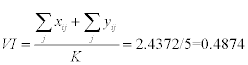
From Table 4, the Agriculture Drought Vulnerability Index (ADVI), was calculated to be 0.4874. Since vulnerability index can take any value from 0 to 1, a suitable continuous probability distribution was assumed (Beta distribution) which is generally skewed and takes values in the interval [0, 1]. Five (5) equal linear intervals were chosen so that each interval has the same probability weight of 20% as proposed to Iyengar and Sudarshan’s Method of vulnerability index calculation (International Crops Research Institute for the Semi-Arid Tropics, 2009). The calculated Vulnerability index fell in a vulnerable category as shown below. This calculated value complements the findings that the study area is vulnerable to drought impacts (Table 5).
| Gender (female %) | Age (estimated average age) | population migration (Estimated number of people who migrated) | health problems (No. of cases) | Education level (< primary and no schooling) | household size (>7 members) | Income level (Estimated average household income level) | water quality (% of people who Disagreed and strongly disagreed) | water and wind erosion of soils (number of households with eroded fields) | Good rangeland management (% disagreed) | Absence of agricultural conservation methods (Number of respondents) | Good public awareness(% disagreed and strongly disagreed) | Average village Vulnerability index per indicator | |
|---|---|---|---|---|---|---|---|---|---|---|---|---|---|
| V1 | 0.2963 | 0.0000 | 0.0000 | 0.0000 | 1.0000 | 0.0000 | 0.2296 | 0.6000 | 1.0000 | 0.4545 | 0.3750 | 0.6500 | 0.3838 |
| V2 | 1.0000 | 1.0000 | 0.3529 | 0.3333 | 0.0000 | 0.1429 | 1.0000 | 0.7000 | 1.0000 | 0.5455 | 0.0000 | 0.0000 | 0.5062 |
| V3 | 0.0000 | 0.9318 | 0.5882 | 1.0000 | 0.1667 | 0.5714 | 0.0000 | 0.9000 | 0.0000 | 0.0000 | 0.1250 | 1.0000 | 0.4403 |
| V4 | 0.1852 | 0.9773 | 0.0000 | 0.6667 | 0.3333 | 1.0000 | 0.7198 | 1.0000 | 0.0000 | 1.0000 | 0.2500 | 0.7000 | 0.5694 |
| V5 | 0.1852 | 0.8636 | 0.7059 | 0.6667 | 0.1667 | 0.7143 | 0.9300 | 0.0000 | 0.0000 | 0.3182 | 1.0000 | 0.9000 | 0.53765 |
| Total | 2.4372 | ||||||||||||
Table 4: Normalised indicators scores.
| Less Vulnerable | 0 |
| Moderately Vulnerable | 0.2 |
| Vulnerable | 0.4 |
| Highly Vulnerable | 0.6 |
| Very highly Vulnerable | 0.8 |
Table 5: Various stages of vulnerability.
This study was aimed at assessing the vulnerability to drought, determining what and who was exposed/susceptible to drought; determine coping strategies to drought used in this study area and use the findings to alert policy makers and those in authority for possible and effective interventions. This study area has been found to be vulnerable to drought impacts, though the index calculation might have been biased because a simple average method that assumed equal weights to indicators was used. The index value could have been better than the found value if the selected indicators were weighted. There is indeed a need for authorities to intervene in order to improve the livelihood of these community members through a variety of options as mentioned under recommendations below.
Droughts have become a global challenge and threat to sustainable development and have had ripple effects ranging from; poverty, food insecurity, health, environment and socio-economic problems. The above mentioned problems have damaging effects on societies when such societies lack coping capacity that easily leads to disasters. From this study it was clear that Koti-Se-Phola community council vulnerability situation is high and bad, posing a challenge to authorities to device strategies to reduce drought disaster impacts. One of the key lessons learned in this study was that residents are low income earners, which in turn reduces their resilience against drought impacts as they cannot buy resistant seeds to plant, use animal plough and irrigation, and result in unsustainable coping capacities such as feeding cows with chicken droppings. The government on the other hand offers little or no assistance to these 80% rain-fed agriculture dependent community with no training and awareness campaigns. Drought is a slow onset hazard (UNISDR, 2009) that affect thousands of people but which many countries do not treat as priority. This is evident in several counties including Lesotho which do not have drought specific policies and this maybe a reason for the poor response to drought issues in the study area. Finally, this study appeals to Government, NGO’s and other relevant stakeholders to join hands and tackle some of the identified problems discussed above which are related to vulnerability to drought disaster impacts, particularly in Mafeteng district. By implementing the recommendations mentioned above, could help boost local community resilience to drought.
From the findings above, it is recommended that Lesotho government decreases the old age pension qualification requirements to 60 years rather than the current 70 years in order to help many residents since majorities are elders aged 60 years and above. The majority of residents in this community are dependent on rain-fed agriculture for livelihood, with low income levels from their limited livelihood sources. It is therefore recommended that irrigations systems that will draw water from rivers such as Makhaleng and other dams be installed to improve livelihood status and provide employment. Since there is serious soil erosion in the fields, agriculture conservation practices could be of great help in not only making savings in labour supply (in a dominantly low labour force community) but in also creating employment opportunities as well as reducing migration rate into towns and other places for livelihood. Stringent policies and laws to be put in place to restrict families in forcing young boys to become shepherds and lastly the government should make education free up to high school level to accommodate the poor families who cannot pay school fees for their children.